

Stokes County Tornado - May 24th, 2017
Click Icons on map for more info
The Track:
The Tornado:
The only known footage of the tornado was taken by a resident at the YMCA camp near Sauratown Mountain: At this point the tornado was reaching maximum width and strength.

Meteorological Synopsis:
Leading up to the severe weather event there was very little indications of the potential for tornadoes across NC. The Storm Prediction Center (SPC) had Stokes Co under a low end "marginal" (1 out of 5) risk for severe weather the night (tuesday evening) before the event. This reflected most weather model guidence which seemed to indicate that weak instability and high cloud cover would limit storm strength.
By Wednesday morning the SPC upgraded the area to a "slight" risk (2 out of 5) and indicated that enough instability could develope that would lead to strong storms. This combined with the certain amount of high wind shear and a strong upper level jet could lead to the potential for tornadoes. This was the first official outlook to mention the possability of tornadoes,15 hours before one touched down in Stokes Co.
Progression in SPC outlook risks
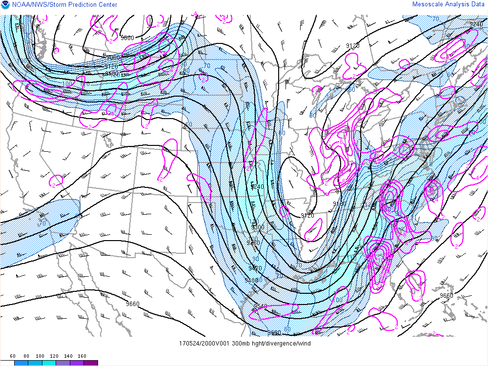
300mb Jet Steam
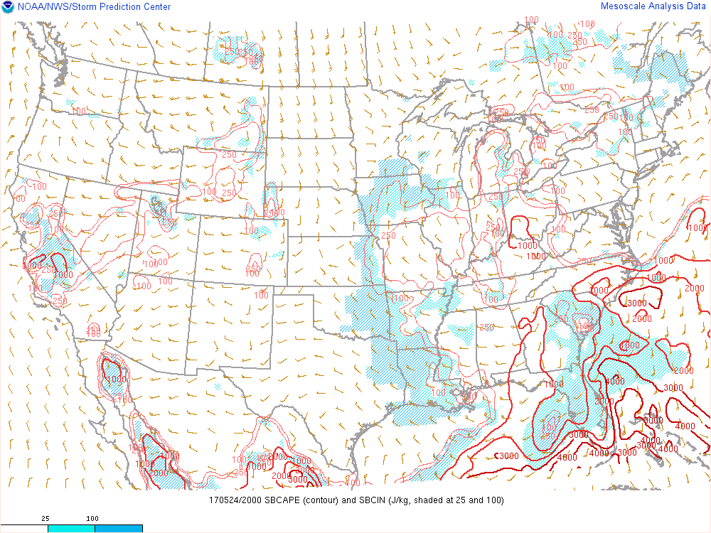
Instability (CAPE)

At 3:45pm the SPC issues a tornado watch as storms across NC intensify...
The NWS Storm Prediction Center has issued a
* Tornado Watch for portions of central and eastern North Carolina eastern South Carolina southwestern Virginia Coastal Waters
* Effective this Wednesday afternoon from 345 PM until Midnight EDT.
* Primary threats include... A couple tornadoes possible Scattered damaging wind gusts to 70 mph possible Isolated large hail events to 1.5 inches in diameter possible
SUMMARY...An area of thunderstorms spreading through the Carolina piedmont will continue northeastward along a frontal zone across the watch area through this evening, accompanied by a risk for tornadoes and potentially damaging wind gusts.
At 4:42pm the NWS in Blacksburg issues a tornado warning for Stokes Co...
The National Weather Service in BLACKSBURG has issued a
* Tornado Warning
* Until 515 PM EDT
* At 442 PM EDT, a confirmed tornado was located over East Bend,moving northeast at 30 mph.
HAZARD...Damaging tornado and quarter size hail.
SOURCE...Emergency Management confirmed tornado.
IMPACT...Flying debris will be dangerous to those caught without shelter. Mobile homes will be damaged or destroyed. Damage to roofs, windows, and vehicles will occur. Tree
damage is likely.
* Locations impacted include...
Pilot Mountain...
East Bend...
King...
Pilot Mountain State Park...
and Pinnacle.

At 4:52pm (10 min lead time) the tornado touches down just inside the Stokes Co line...
This was not the first time this storm had produced a tornado however, less than 30 minutes earlier it produced one over Yadkin and Davie counties. Due to these previous reports the NWS was able to get warnings out quicker for the Stokes Co area. Those in the path of the first tornado had less than a 3min lead time, while many in Stokes had between 10-15min

The Damage:
More images coming soon, please click survey points in the interactive map above for additional photos.